Lower Dolpo Trek

Highlights
- Explore remote Lower Dolpo, rarely visited despite opening to trekking in 1989.
- Witness stunning vistas of the Trans Himalayas, resembling Tibetan highlands.
- Immerse yourself in the rich culture of nomadic people who follow ancient traditions in these rarely visited areas.
- Conquer three challenging high passes - Kangmara La, Baga La, and Numa La - adding a sense of achievement to your journey.
- Witness the beauty of Phoksundo Lake, the highlight of the trek, nestled amidst the rugged terrain.
Overview
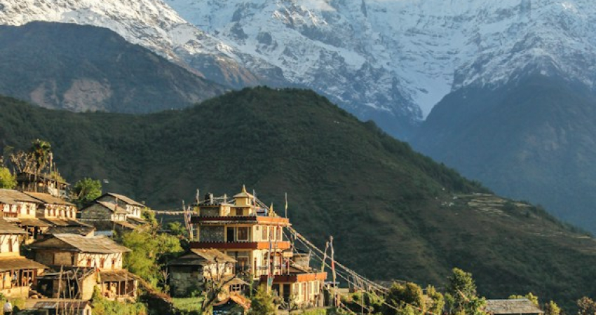
The Lower Dolpo trek is an adventurous 18-day journey to explore the untouched and remote beauty of Nepal. This region opened for trekking in 1989 but has remained largely unexplored due to its isolated location. Lower Dolpo, situated in the Trans Himalayas, offers stunning landscapes resembling the Tibetan highlands.
Starting from Jhupal, the trek takes you to remote locations with breathtaking views of the Himalayas. The colorful barren slopes of the mountains and the untouched wilderness make this trek unique. You'll traverse through rarely visited areas, experiencing the rich culture of nomadic people who follow ancient traditions.
The trek includes three challenging high passes – Kangmara La, Baga La, and Numa La – adding a sense of achievement to the journey. Although the trek is strenuous due to harsh weather and rugged terrain, the highlight is reaching the tranquil Phoksundo Lake and marveling at its beauty. Overall, the Lower Dolpo trek offers a perfect blend of mountain vistas, high passes, lush valleys, and a glimpse into the unique Tibetan-influenced culture of the region.
The trail to Lower Dolpo passes through Shey Phoksundo National Park therefore, Lower Dolpo Trek is an opportunity to encounter varieties of unique floras and faunas. The people residing in this area are simple, helpful and friendly. The people residing in this region are the descendants of Tibetan who still practice pre Buddhist Bon religion. Their lifestyle is very simple and traditional. They have their own unique dialect that resembles the Tibetan language. If you are ready for the challenge of trekking to Lower Dolpo region of Nepal, then contact Backpacker Treks . With the general permit to Shey Phoksundo wildlife reserve and special permit to Lower Dolpo region, Backpacker Treks will do its best to make your journey worth it!
- Day 1 - Arrive at Tribhuwan International Airport (TIA) Kathmandu.
You are welcomed by hospitable meeting and then you will be transferred to hotel. Our airport representative will explain briefly the program upon arrival. Overnight at hotel. B.B
- Day 2 - Trek Preparation and Kathmandu Valley Sightseeing Tour.
Sightseeing of world heritage sites in Kathmandu valley including, Kathmandu Darbar square, Swayambhunath Temple, Boudhanath Stupa & Pasupatinath Temple. Overnight at hotel. B.B
- Day 3 - Flight Kathmandu - Nepalganj
To get to dolpo region, generally you have to fly to Nepalgunj first. Nepalgunj is a steaming hot city in South Western Nepal, in the lowlands of Terai, close to the Indian border, which is just 8 km away. Culturally the area more resemble India than upland Nepal.
Take a cycle rikshaw for a ride in town. You pass the hustle and bustle of the bazaar and see horse carts full of colorful people going to or coming from the Indian border. The Bageshowri temple is one of Nepal’s most important Hindu temples and is worth a visit as well. Overnight at hotel. B.L.D
- Day 4 - Flight Nepalgunj-Juphal (2475 m), walk to Dunai (2140 m) 2.5 hrs
It’s just a 35 minutes flight to Juphal over steep mountain ridges with beautiful views of snowcapped mountains. Juphal airport is just a gravel airstrip amidst the mountains, which guarantees a spectacular landing. Stepping out of the plane, you enter in a completely different world. From a hot city in the plains, you arrive in a small mountain village, situated in the midst of the Himalaya, breathing in crispy cold air. From Juphal you walk down over a small path among fields with wheat and vegetables to the Thuli Bheri River, which you’ll follow after reaching it. Overnight at tented camp. B.L.D
- Day 5 - Dunai (2140 m) to Lingdo (2391 m) 5 hrs
Leaving Dunai, you soon walk in a beautiful mountain landscape, which sometimes reminds to the European Alps. Rocky slopes are dotted with pine trees, mostly blue pine. At the horizon you see the snowcapped Kang Tokal (6294 m). The path goes slightly up and down, following the Thuli Bheri River, once and a while passing a couple of houses.
You cross the Buddhist village Byasgar (2427 m). After leaving Dunai, all the villages you’ll come across are inhabited by Buddhist people. The people who live in this region are Tarali’s, a Magar group.
After Byasgar, the landscape gets quickly more rough and rocky. The path is sometimes carved out of the rocks, and at a few points very narrow. There are plans to make a motor able road all the way to Dho Tarap. Walking here, it seems that this is a huge challenge, and it surely will take a couple of years. But, it might be a reason not to wait too long if you want to visit Dolpa… You reach Lingdo, a small village which has one guesthouse, with a campingsite. Plus a checkpost, so have your permit at hand. Overnight at tented camp. B.L.D - Day 6 - Lingdo (2391 m) to Laina Odar (3370 m) 6 hrs
The path is gradually going up. Along the way you have a good view to some of the villages in this region, like Sarakot, which is situated high on a cliff. These are the last villages you will see till you reach Dho Tarap. You pass some mani walls (a wall with loose stones with Buddhist mantra’s carved on it) and chortens. According to Buddhist custom, you have to pass these Buddhist shrines on the left side, so clockwise. At the horizon you can see the beautiful snowcapped Kang Tokal. The landscape is impressive and sometimes very green. Sharp rocks are dotted with junipers and other pine trees. If you are lucky, you can see groups of large grey monkeys here.
The trail climbs high on a slope and goes high above the Thuli Bheri River, leading to a large suspension bridge (120 meter long), high above the river as well. You reached Laisicap (2772 m). On the other side of the bridge, there is a tent-hotel, where you could stop for a dal bhat or noodle soup or fill up your stock of snacks. Tent-hotels are big Tibetan tents, set up to serve food and drinks to travelers. Besides local restaurants, they serve as a shop as well, and you can buy a variety of items here, like biscuits, juice, Lhasa beer, shampoo, etc.
After Laisicap it’s a long and strenuous climb of about 3 hours to Laina Odar (3370 m). The path partly goes through forests and you are surrounded by steep cliffs full of pine trees, some of which are huge. You find yourself high above the river. Close to Laina Odar, the path goes alongside the river again. Overnight at tented camp. B.L.D - Day 7 - Laina Odar (3370 m) to Nawarpani (3475 m) 4 hrs
After leaving Laina Odar, the trail goes up to a small pass, which takes about 45 minutes climbing to reach it. After the pass, it’s a fairly easy walk with a few small climbs. It’s a beautiful walk again, sometimes going through pine forests, with a wonderful smell. About 4 hours after leaving Laina Odar, you reach Nawarpani (3475 m), where you find another tent-hotel. You can camp here. If you are feeling well and in good shape, you could continue and walk to Sisaul (3750 m) today. Overnight at tented camp. B.L.D
- Day 8 - Nawarpani (3475 m) to Sisaul (3750 m) 3.5 hrs
After Nawarpani the landscape quickly gets more barren. There are only few trees. You mostly walk in the river valley with high rocks towering above you on both sides. In this barren landscape the bluesheep lives. If you look out for them you have a big chance to see big groups high on the slopes. Besides, if you are really very lucky, you might even spot a snowleopard…
It’s a fairly easy walk, gradually going up. At some parts the path is beautifully carved out of the rock, so that you find yourself walking in a kind of three sided tunnel. The path climbs steeply for about half an hour to a small pass with a nice chorten (stupa). From the pass, it’s 30 minutes till Sisaul (3750 m). Overnight at tented camp. B.L.D
- Day 9 - Sisaul (3750 m) to Dho Tarap (4080 m) 4 hrs
Leaving Sisaul, the trail climbs to another small pass. Shortly after the pass, the valley suddenly widens. The landscape has changed completely. It’s very dry and small bushes have taken the place of the trees from before. Gradually you will notice these bushes disappearing almost completely as well.
The trail stays besides the river. At the horizon a small collection of houses is appearing in between the mountains: Dho Tarap. Getting nearer to Dho Tarap, you cross many mani walls and small chortens. It makes you realize how important Buddhism is for the people of Dolpa. Buddhism is interwoven in each and every aspect of people’s life here. Behind Dho, you can see the gompa (Buddhist monastery) of Dho, situated on a hill.
The people of Dho are direct descendents of Tibetans, which you can notice easily by their faces and their dress. The women wear dark dresses with colorful aprons made from yak wool. Many women wear bracelets of big shells and some have beautiful silver and turquoise headgear. Most men have long hair, some wear a red ribbon in their hair, in the style of Tibetan Khampas.
Their typical dress is a long coat, from which they let one sleeve hanging down. The people in Dho are very friendly. A Tashi Delek (good day, like the Nepali Namasté), is always welcomed with a big smile. Overnight at tented camp. B.L.D
- Day 10 - Dho Tarap (3944 m) to Numala Base Camp (4440 m) 3 ½ hrs
As it is only a 3 ½ hours walk to Numala Base Camp, so you can use the morning to explore Dho and surroundings. Leaving Dho, you pass a beautiful gate chorten. After more or less half an hour, you arrive at the Crystal Mountain School, which is educating children from Dho and surroundings. It is sponsored by a French NGO. If you want, you can visit the school, the teachers are very pleased to show you around. From the school, it’s about half an hour to Tokyu (4209 m), a spread out village, which is said to be the highest permanent settlement in the world.
The gompa is at the end of the village, and is worth a visit. It has a beautiful statue of Maitreya, the Future Buddha. From the gompa, it is a gradual climb of about 1 ½ hour over grassy land to Numala Base Camp (4440 m). It’s in the middle of nowhere, but close to the river and you find a small house for cooking here.
- Day 11 - Numala Base Camp (4440 m) to Danigar (4631 m) via Numa La (Pass) (5318 m) 6 hrs
A tough day lies ahead of you. It’s a good idea to start early (between 5 and 6 am), to arrive early at the pass. In the morning the weather generally is best which makes the crossing of the pass easier and safer.
Besides you have more chance to have a good view of the mountain ranges from the pass, as later in the day clouds tend to cover the peaks.
It’s a long and strenuous climb of about 3 hours to Numa La (la means pass) at 5318 m. The altitude makes you go slow and you get out of breath quickly. But it’s definitely worth it.On a clear day you have a stunning view from the pass on countless snowcapped mountains. Daulagiri (8167 m) is towering above them to the right. Besides, you can see the Annapurna and Manaslu Range, the Shey Shikar (6139 m), Kanjirowa (6883 m) and many, many others.
In spring there can be snow on the pass, which makes the crossing a bit harder. After the pass you go down steeply for about an hour. Then the path becomes pretty level and later climbs slowly but steadily again for about an hour. As the river is going down quickly, you find yourself soon high above the river.
After a couple of turns, you arrive at a meadow, which is the campsite for today, Danigar (4631 m). It’s an amazing spot close to the river (Panklanga Khola). To the south the beautiful snowcapped Norbung Kang (6085 m) is towering high above the campsite. On the other side of the river there are high pastures, which are often used by yaks to graze. Overnight at tented camp. B.L.D
- Day 12 - Danigar (4631m) to Yak Kharka (3982m) via Baga La (5190 m) 6 hrs
Another pass to cross today, so another tough, but beautiful day lies ahead of you. Again, an early start is best. The path continues on the slope on the other side of the Panklanga Khola and climbs pretty steep, going “zig zag” over the slope.
Soon you are high above the river. A good 2 hours after leaving camp you reach the high camp, which is already close to the pass. From here you have an excellent view on the Norbung Kang and the Baga La range. Pretty soon after the high camp you can observe the last stretch of the path to the pass, climbing very gradually in a half circle over the slope to Baga La (5190 m). From the pass you have a splendid view on many snowcapped mountains like Kanjirowa and Shey Shikhar. In spring there can be snow on this pass as well.
After the pass, the path descends pretty steep at the beginning. This part can be icy which makes it slippery, so watch your step! You walk in a stunning scenery of huge rocks in all kind of colors with at the horizon mountains covered with snow. And then, suddenly, more or less 1 ½ hour after leaving the pass, you will see green bushes and a bit later even trees. In the distance you can observe green meadows far below you. A beautiful sight after those days without any trees.
Besides, you will see a couple of beautiful waterfalls along the way. It’s rather flat and easy walking, very gradually going down, till you reach Yak Kharka (3982 m), another beautiful place to camp. You have a great view of the imposing Kanjirowa Himal (6612 m). Besides, in spring the meadows are full with flowers. Overnight at tented camp. B.L.D
- Day 13 - Yak Kharka (3982 m) to Ringmo/Phoksundo Lake (3733 m) 2 .5 hrs
It’s a short hike today, and if you have the energy, you can even walk this part at the same day as crossing the Baga La. Pretty soon after leaving Yak Kharka, the path starts to climb high on the slope, and the river (Maduwa Khola) is soon far below you.
The path is going up and down and stays level sometimes: that is what they call Nepali flat. The path is beautifully carved out of the rocks and leads to a small pass. After the pass, the path goes into a pine forest. If you detour from the path soon after entering the forest and go to the left to the edge of the ridge, you can see a nice waterfall. You walk through some beautiful pine forests and meadows and it’s nice to hear the birds singing. Leaving the forest, you cross a small bridge from which you climb in a couple of minutes to Ringmo.
- Day 14 - Phoksundo Lake (3733 m) to Chhepka (2838 m) via Rechi (2940 m) 7 hrs
You can walk the following stretch in two short days, or one long day. Walking time to Rechi is about 3.5 hours and from Rechi to Chhepka is 3 .5hours as well. The walk to Rechi goes almost entirely through beautiful pine forests, with some bushes, birches and other broad leaved trees mixed in. Leaving Ringmo, the path is rather flat at first, but soon climbs steeply up the hill. Soon you will see the river far below you. Overnight at tented camp. B.L.D
- Day 15 - Chhepka (2838 m) to Juphal (2475 m) 6 hrs
Today it is most of the times descending, with some small climbs in between. The first part is going through the forest again, with below you the wild flowing river. After the village of Shyanta you leave the forest, and suddenly you walk through a bit dry landscape. In front of you, you can see a part of the Dhaulagiri range.
You pass villages like Sangta (2520 m) and Kageni (2413 m) and reach the check post of the Shey Phoksundo National Park (SPNP) again. After crossing a big iron suspension bridge (the Dhim Bridge, 99 m long) you go left (west) to Juphal (if you would go right (east), you’ll arrive in Dunai again (45 minutes walking)
From the bridge, it’s about 3 hours to Juphal. The first part goes over a large path, passing through the small village of Kalagaonda. Then you leave the main road and walk over a small path, through fields of barley and wheat, with walnut, peach and apricot trees. It’s a pretty steep climb to reach Juphal. Overnight at tented camp. B.L.D
- Day 16 - Flight Juphal-Nepalgunj-Kathmandu
Early in the morning you fly to Nepalgunj. Especially the first part of the flight through the mountain valleys is spectacular. Later in the day, you fly back to Kathmandu.
- Day 17 - Leisure day in Kathmandu.
Leisure day in Kathmandu. Overnight at hotel. B.B
- Day 18 - Transfer to the International Airport for your home departure. B. “Farewell”
Transfer to the International Airport for your home departure. B. “Farewell”
- Airport / Hotel / Airport pick up & transfer by private car / van
- Four nights accommodation with breakfast at a 3-star category hotel in Kathmandu
- Kathmandu city tour as per the above itinerary
- One night accommodation in Nepaljung
- KTM - Nepalgunj-Juphal - Nepalgunj-KTM airfare including departure tax
- Meals on full board (breakfast, lunch, dinner, tea & coffee) prepared by our expert cook
- Twin sharing tented accommodation during the trek
- An experience guide (trained by Ministry of tourism), required number of porters, their food, accommodation, salary, insurance, equipments
- Trekking equipment (two men tent, dining tent, kitchen tent, table with chairs, kitchen utensils, and other necessary equipments during the trek)
- Special trekking permit
- shey phoksundo national park entry fees
- Sleeping bag during Lower dolpo trek
- Safe drinking water, boiled/iodine tablets.
- First aid medical kit bag.
- All government and local taxes.
- Office service charge.
- Lunch and dinner in Kathmandu
- Travel insurance
- International airfare
- Nepal entry visa: you can obtain a visa easily upon your arrival at Tribhuwan International Airport in Kathmandu. (a multiple-entry tourist visa good for 30 days can be obtained by paying US $ 40 or equivalent foreign currency. Similarly, multiple-entry tourist visas for 90 days can be obtained by paying US $ 100. Please bring 2 copies of passport-size photos.)
- All cold drinks such as: alcoholic beverages, mineral water, Coke, Fanta, juice, etc
- Hot showers during the trek
- Personal shopping and laundry
- Personal trekking equipments
- Tips for trekking staff and driver (Tipping is appreciated and it is mandatory)
Important Information
The Lower Dolpo Trek set departure dates are tailored for the group joining option. If the -days Lower Dolpo Trek departure dates don't fit your schedule, we can include alternative dates that better suit your needs.